
Hiking on Møn, the Camønoen
The Camønoen is a 175 km circular trail across Møn, Nyord and Bogø, with stages, rest stops, a stamp passport and tips for day hikes or the full route.
Contents
Møn is best experienced on foot, and the centrepiece for that is the Camønoen: a 175-kilometre circular trail that opened in 2016 and links the islands of Møn, Nyord and Bogø. It starts and finishes at the Møns Museum in Stege, from where the route loops through every landscape the region has to offer, from chalk cliffs to beech forests and fields, salt meadows and small harbours. The trail is deliberately designed as a gentle, welcoming route, where enjoyment and nature come before athletic achievement.
The route at a glance
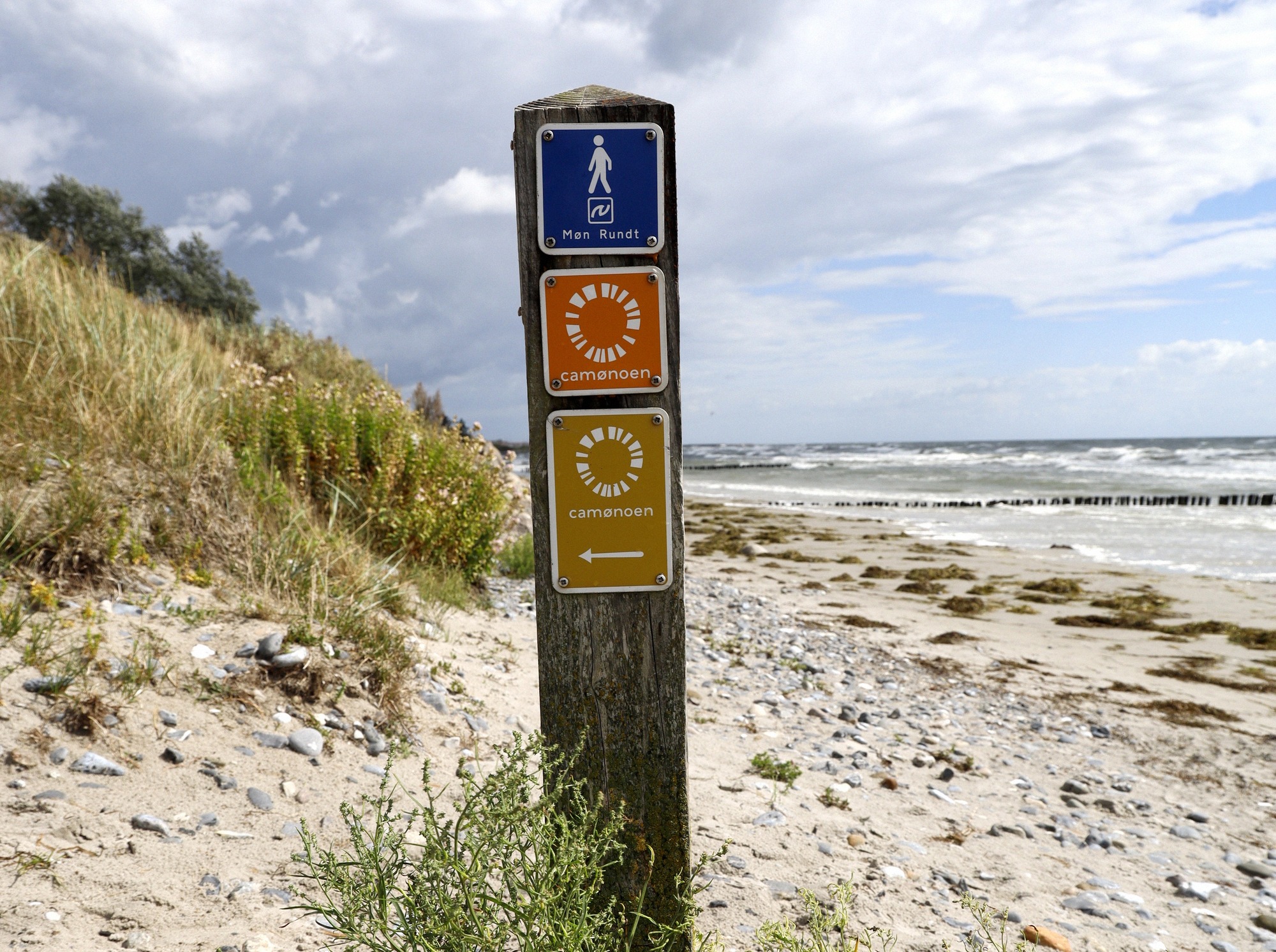
The Camønoen is a continuous circular trail, divided into 10 main stages plus 2 shortcuts. Each stage begins at one Camønopause (rest stop) and ends at the next, so the route breaks down neatly into day-sized sections. It's marked throughout, in both directions, with the orange Camønoen symbol, so you can walk it clockwise or anticlockwise.
The official stages and their lengths give a good sense of how varied the sections are:
- Enebæretapen (Juniper Stage) - 15 km
- Fugleetapen (Bird Stage) - 19.5 km
- Klinteetapen (Cliff Stage) - 16.6 km, plus the Borre shortcut at 7 km
- Mælkevejen (Milky Way Stage) - 12.7 km
- Havetapen (Sea Stage) - 38.1 km, the longest stage
- Mølleetapen (Windmill Stage) - 10.3 km
- Surfetapen (Surf Stage) - 8.7 km, the shortest stage
- Kong Asgers Etappe - 27.3 km
- Færgeetapen (Ferry Stage) - 8.8 km
- Museumsetapen (Museum Stage) - 10.9 km, plus the Elmelunde shortcut at 5 km
Walking the entire route takes 7 to 10 days, depending on pace. But the lengths also show how flexible the planning can be: short stages like the Surf or Ferry Stage are an easy half-day walk, while the 38 km Sea Stage calls for either stamina or splitting it in two.
Rest stops, stamp passport and the golden pin
A hallmark of the Camønoen is the Camønopauser, small rest stops along the route where hikers can pause and stamp their passport. They're spaced for walkers of every pace, and each one lets you add the local stamp to your booklet.
That booklet is the Camøno passport, a personal stamp booklet and small travel diary. It costs 45 DKK and is available online via the Camøno shop or directly from the Møns Museum shop in Stege. Hikers who complete the route with respect for nature and locals can buy a golden pin bearing the Camønoen logo at the end, the purchase supports the Camønoen partner fund, which channels money into projects for hikers and island residents. Official sources don't consistently state whether the pin is tied to a set number of stamps; it's intended mainly as a keepsake and a way to give something back, not as proof of athletic achievement.
There's also a printed Camønoen map (75 DKK) marking water points, shelters and facilities, useful especially on the longer stages, where supplies aren't available everywhere.
Character and difficulty
Overall, the Camønoen is moderate to walk, though the surface changes noticeably: asphalt, natural path, forest floor, gravel and sand alternate along the way, and over 70 percent of the route follows paved paths. That keeps large stretches walkable even in wet weather.
It gets more demanding in the east of the island: the stages around the chalk cliffs are hillier, with elevation changes of up to around 100 metres over short distances. No reliable source gives the cumulative elevation gain for the full loop, overall, though, the trail isn't an alpine undertaking, more one that's demanding in specific sections. If you're only walking the scenic cliff sections, expect a steep character there and wear sturdy shoes.
The continuous waymarking is enough for orientation. For digital navigation, there's the free Oplev Møn app. The museum doesn't offer an official GPX file for the whole route; if you want to walk with a GPS track, community tracks on Komoot or Outdooractive are the way to go.
Sleeping, supplies and luggage transfer
For multi-day trips, sleeping and food are the key questions, and the Camønoen is built with that in mind. Along the route there are 9 free shelters, each with space for four people, plus rest stops with water, toilets, power and weather cover. Important: wild camping isn't allowed, overnight stays are only permitted at designated sites, in line with Denmark's wild-camping rules.
If you prefer more comfort, fixed accommodation partners are dotted along the route: Motel Stege, Pension Elmehøj, and Villa Huno, which combines a hotel with glamping, along with camping, farm stays and shelters. B&B prices start at around 500 DKK per night. For longer trips, a luggage transfer between accommodations is also available through the Camøno office (Camønobureauet), so you can walk with just a light day pack. Firm prices and booking details change seasonally, so it's worth checking directly.
The same caution applies to supplies as to sleeping: not every stage passes a place to eat or buy provisions, and on the longer sections it pays to carry water and food. The printed map showing the water points helps with planning.
Highlights along the way
The Camønoen strings together the region's landscape highlights like beads, and a few of them are worth a longer stop.
- Møns Klint and Høje Møn: The stretch of coast with the chalk cliffs is the trail's scenic centrepiece. Right on the route is the GeoCenter Møns Klint, open from Easter (28 March) to 30 October 2026, closed over winter. Admission is 155 DKK for adults and 100 DKK for children aged 3 to 11 (10 DKK cheaper online), with parking at 45 DKK. The cliffs are eroding, so stick to the marked paths.
- Nyord and the bird meadows: About a kilometre past the bridge to Nyord stands the two-storey Nyord Enge bird observation tower, free to enter and open to everyone, with a wheelchair-accessible platform. The meadows themselves are off-limits to walkers under a 1975 protection order. The best months for birdwatching are April-May and September-October; in 2026 the tower holds open days on 30 August, 27 September and 25 October.
- Bogø and the Ferry Stage: The Færgeetapen crosses the small island to the west, quiet, flat and with a harbour atmosphere, a real contrast to the dramatic east coast.
For more background on individual sights, it's worth browsing the town and nature pages; if the chalk cliffs are your main focus, it's a good idea to combine the cliff stages with a visit to the GeoCenter.
Best time to go and getting there
The Camønoen can be walked all year round, though some accommodation only opens in summer, and a few places close for the autumn. If you're relying on fixed accommodation, check opening seasons before setting off.
Which season suits you depends on what you're after:
- Spring (April-May): orchids on the chalk hills and migrating birds passing through.
- Summer (June-August): peak season, with the warmest weather and clear dark-sky nights in August. May to July is generally considered the best window for nature and wildlife.
- Autumn (September-November): glowing beech forests and arriving cranes.
More detail is in the guide to the best time to visit Møn.
Getting there: the starting point is the Møns Museum in Stege, which also has parking. Most visitors arrive via Copenhagen, from where it's about 1 hour 25 minutes by car across the toll-free Dronning Alexandrines Bridge. Without a car, the journey by train and bus takes around 2 hours 22 minutes, by rail to Vordingborg and then bus route 660 to Stege (also running on Saturdays and Sundays), or to Nykøbing Falster and bus route 750 (Monday to Friday). More on arrival and onward travel is in the getting to Møn guide.